Thursday, April 8, 2010

Last Rio Stop


Well, here we are in Rio de Janeiro on Easter Weekend. This is the last stop on this cruise around South America. We are staying at a three star hotel in the Catete District of the city. From the rooftop pool deck we have a great view of the surrounding neighborhood and we can see the Monument on Corcovado Mountain. It is a medium size hotel with a restaurant, a roof top bar and exercise room and a business center with Internet availability. A good place to camp out for a few days to see more of the city.

We decided to take a ride on the subway, or Metro. The cost for a one way ride of any distance on any line is only $2.80 Brazilian Real or about $1.50 US. There are a lot of historic buildings in the Centro area and it was fun to walk around and look at the different types of architecture. The European Influence in the art and architecture of Rio is beautiful.

The next day we took went to the Meseu da Republica that is just down the street from our hotel. The building was constructed in the late 1850’s and was the presidential residence from 1897 to 1954. The Palace is beautiful and the rooms and furnishing all very well maintained. The last Brazilian President to use the Palace as a residence was Getuilio Vargas who served as President for 24 years. He committed suicide in his bedroom in August 1954. The bedroom can be visited and the pajamas he wore and the handgun he used to take his own life are on display.

From the Palace we got back on the Metro and headed to the Carioca Station again where we could walk to the Estacao dos Bondes, the station for a very old street car system that has been in use for more than 100 years. We rode the streetcar up the hills toward the Santa Tereza District. The narrow streets and colorful houses made for a fantastic trip. The view of the city and the Favala, the housing for the poor, along the way was terrific. Part of the ride travels over the Aqueduct that was used a long time ago to bring water from the mountains to the city. The cost for the ride is $1.20

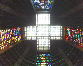
We had lunch at the small restaurant at the station and then walked over to the Cathedral Metropolitana. This huge church, shaped like a cone was built in the early 1960’s and is most unusual in design. As many a 5000 can be seated for a service and more than 15,000 for standing room. It is the most unusual church I have ever seen.

This evening is our last night in Rio, and it is raining cats and dogs, or should I say Cats and Agoutis (small animal that looks like a groundhog, but is smaller and has longer legs). A few days in Buenos Aires a 40 day cruise to eight South American Countries and finally a few days in Rio de Janeiro. Can you think of a better way to see the world?

Monday, April 5, 2010

Río de Janeiro


It's Friday, April 2, 2010, and we arrived in Guanabara Bay just outside of Rio de Janeiro, the last stop on our 40-day adventure to South America. As we look west toward the city we see the mountains poking up and touching the clouds all around Rio. European Explorers first discovered this area on January 1, 1502.

We take a scenic drive through both the old and the new parts of the city as we make our way to Cosme Velho District, which is at the foot of Concovado Mountain. This is the most photographed place in Brazil. Built of white marble, standing 120 feet tall on the top of Concovado is the statue of Jesus Christ with outstretched arms. To reach the monument and see the city from that vantage point we must ride the cogwheel train to the summit. The lines to see the monument are long. The reason is that today is Good Friday. One of the holiest days, in this, the most populous Catholic country in the world.

Sadly the monument is completely covered with scaffolding and special protective covers. Just two weeks ago, for the first time in 70 years, a cleaning and restoration had begun. It is expected that the complete process will take as long as six months. This reminds us of the time we visited Venice and discovered that the front of St. Mark’s Cathedral in St. Mark’s Square was undergoing similar restoration.

After leaving the monument we headed to the Leblon section of the city for a special treat, a traditional Brazilian Churrascaria lunch. In addition to traditional side dishes of rice and vegetables a wide selection of seafood was available today because of Good Friday - filet, roasts, ribs, chicken, sausages, all in unlimited quantities. A fabulous lunch and a great introduction to Brazilian culinary artistry.

We left Leblon and headed toward Sugar Loaf Mountain. Along the way we drove along the beachfront avenue to see the world famous beaches at Copacabana and Ipanema. Beautiful sandy beaches with blue-green water and the walkways are lined with coconut palm trees. Lots of people on the beach because it is a holiday weekend and the weather is fantastic for sun worshipers.

After we arrived at the mountain we boarded the first cable car for a short ride up to Urca Hill, there is a lovely garden up top and the view is terrific. We then boarded the second cable car up to the 1,200 summit of Sugar Loaf Mountain. On the way up we could see mountain climbers working their way up to the summit. The panoramic view of Rio de Janeiro from the top of the mountain is spectacular.

A beautiful introduction to one of the largest and most famous cities in the world and a terrific ending to our big adventure. Back to the U.S. and home, sweet, home.

Sunday, April 4, 2010

Racife, Brasil


We arrived early in the morning at the Port of Recife, Brazil. This is the capital city of State of Pernambuco located in the northeastern part of this huge country. Recife is built around three rivers and connected by 49 bridges. The city’s name comes from the recifes (reefs) that line the coast. It is a beautiful day and the temperatures are expected to be in the upper 80’s by noontime. The view of the skyline of the city from the ship as we were arriving is quite impressive. A lot of seaside high rise apartments and condominiums stand like soldiers guarding the city. To the south in what appears to be the older residential part of town stand two very tall towers, just now beginning to be occupied by tenants we were informed.

We began our tour of the city by driving over a number of bridges. The rivers are tidal and the tide was out, thus exposing a lot of mud islands in the rivers. We saw fishermen with nets wading in the water setting and gathering their nets, hoping to catch some small fish. Years ago the rivers were navigable and were used by boats to ship sugar cane to Europe and North America. The continued deforestation in the interior of the country, caused a significant increase in silt being sent down river, thus making them too shallow for large boats. The expense of dredging was said to be too high, so now all the old sugar warehouses lie abandoned along the waterway. A major project is expected to begin next year to tear down the old buildings and start to rebuild luxury homes with a view of the rivers.

Our first stop was the Golden Chapel that is part of the Convent and Church of St. Anthony. It is beautifully maintained and our guide told us that there are hundreds of pounds of gold leaf covering wood and plaster in the Chapel. The artwork would rival any that I have seen in Venice or Rome. The sacristy was open to us and contains beautifully finished furniture that is used for the priest’s vestments.

We then headed to Olinda, which is at the top of the hill overlooking the harbor and the city. Olinda is very old and is where the first settlement was established. The streets are very steep and narrow and paved with cobblestones. The town is very well maintained and the buildings very colorful. Evidently many artists have moved into Olinda and converted many of the former residences into art studios and shops. We were treated to an ice-cold fresh coconut, cut open and given a straw to drink the “coconut water,” a tropical treat to say the least.

We then had a tour of the Alto de Se Cathedral, a very old and beautifully maintained church. All white and dark wood, a very simple building that has an incredible view of the city from the side courtyard. This is definitely a city worth more time in the future.

Spanish:

Llegamos temprano en la mañana en el puerto de Recife, Brasil. Esta es la ciudad capital del Estado de Pernambuco situada en la parte noreste de este enorme país. Recife está construido alrededor de tres ríos y conectadas por 49 puentes. El nombre de la ciudad proviene de la Recifes (arrecifes) que bordean la costa. Es un hermoso día y las temperaturas se espera que estén en la parte superior de los 80 por medio día. La vista del skyline de la ciudad desde el barco a medida que iban llegando es bastante impresionante. Una gran cantidad de apartamentos de gran altura junto al mar y condominios de pie como soldados que custodiaban la ciudad. Hacia el sur en lo que parece ser la parte más antigua residencial de la ciudad se levantan dos torres muy altas, sólo ahora comienzan a ser ocupadas por inquilinos se nos informó.

Comenzamos nuestro recorrido por la ciudad al pasarle por encima una serie de puentes. Los ríos son de marea y la marea estaba baja, lo que expone una gran cantidad de islas de barro en los ríos. Vimos los pescadores con redes de caminar en el agua establecimiento y recogiendo sus redes, con la esperanza de pescar algunos peces pequeños. Hace años, los ríos eran navegables y son utilizados por los barcos para enviar la caña de azúcar a Europa y América del Norte. La deforestación continúa en el interior del país, provocó un aumento significativo de sedimentos de ser enviado río abajo, lo que los hace demasiado poco profundo para barcos grandes. El costo de dragado se decía que era demasiado alto, así que ahora todos los almacenes de azúcar de edad se encuentran abandonados a lo largo de la vía acuática. Un importante proyecto se espera que comience el próximo año para derribar los edificios antiguos y empezar a reconstruir las casas de lujo con vistas de los ríos.

Nuestra primera parada fue en la Capilla de Oro que forma parte del Convento e Iglesia de San Antonio. Está muy bien mantenido y nuestro guía nos dijo que hay cientos de kilos de hoja de oro cubierta de madera y yeso en la Capilla. La obra de arte que cualquier rival que he visto en Venecia o Roma. La sacristía estaba abierta para nosotros y contiene bellamente acabados de muebles que se utiliza para la vestimenta del sacerdote.

A continuación, se dirigió a Olinda, que está en la cima de la colina con vistas al puerto y la ciudad. Olinda es muy antigua y es donde el primer asentamiento fue establecido. Las calles son muy empinadas y estrechas y empedradas con adoquines. La ciudad está muy bien mantenido y los coloridos edificios muy. Es evidente que muchos artistas se han mudado a Olinda y convirtió a muchos de las antiguas residencias en estudios de arte y tiendas. Nos trataron de un coco fresco helado, corte y teniendo en cuenta una paja para beber el agua "coco", el dulce tropicales por decir lo menos.

Luego tuvimos una gira por el Alto de la Catedral de Se, un muy antiguo y bellamente mantenido iglesia. Toda la madera blanca y oscura, un edificio muy sencillo que tiene una vista única de la ciudad desde el patio lateral. Esto es definitivamente una ciudad vale la pena el tiempo más en el futuro.

Fortaleza, Brasil


We are experiencing Palm Sunday in a very Roman Catholic Fortaleza, Brazil. We arrived at about 8:00 a.m. at this Northeastern Brazilian city of 2 million. Fortaleza called the “City of Light," claims that the sun shines on it 2,800 hours per year. Unfortunately we cannot count ourselves among those hours today. It is very cloudy and we had a few showers just as the Sunset Seas was getting to the dock. The city originally sprang up around a Dutch Fortress built in 1649. After the Portuguese defeated the Dutch, the small settlement was renamed Fortaleza Nossa Senhora de Assuncao (Fortress of Our Lady of the Assumption). Today, it is the capital of the Brazilian State of Ceara and is the country’s fifth largest city.

Our tour began at about 9:00 a.m. and because it is Sunday, traffic was minimal. Our first site was the Teatro Jose de Alencar, named in honor of the 19th Century novelist and poet. A beautiful old structure of wrought iron and wood,it is the heart and soul of the theater community in Fortaleza and is very well maintained. Our next stop was at the neo-Gothic Cathedral, a bold structure that is anything but beautiful on the exterior. It has the appearance of an unwashed, stained sandstone church. Crowds of people were participating in the Mass when we arrived and a sort of quirky fruit drink truck with a band on the roof was waiting outside the cathedral for some event that most likely was going to take place following the Mass.

Along the way to the next stop we had the chance to see much more of Fortaleza. The tall residential apartment complexes are all on the leeward side of town facing the ocean. The smaller buildings, housing older residential buildings and businesses are on the windward side of the city. We were told that this was by design so as not to block the constant breezes to the older side of the city with the new and very modern high rise part of the city where most of the middle class people live.

We arrived at The Emcentur Tourist Center, the city’s flourishing handcraft market, which is housed within a former prison. It was hard to imagine that we were walking through the cellblock of a century old prison that has been converted into a beautiful marketing area. We headed back to the ship taking the coast road and had the chance to see the Sunday bathers bobbing in the warm South Atlantic waters at Iracema Beach. Continuing along we passed the fishing village that was packed with small flat bottom boats that were being made ready for tomorrow’s work.


Spanish:

Estamos viviendo en un Domingo de Ramos muy Fortaleza Católica Romana, Brasil. Llegamos a las 8:00 de la mañana en esta ciudad del noreste brasileño, de 2 millones de dólares. Fortaleza llamada la "Ciudad de la Luz", afirma que el sol brilla en ella 2.800 horas al año. Lamentablemente no podemos contar entre esas horas de hoy. Es muy tarde y tuvimos algunas lluvias al igual que los mares del atardecer estaba llegando a la muelle. La ciudad originalmente surgió en torno a una fortaleza construida en 1649 neerlandesa. Después de los portugueses derrotaron a los neerlandeses, el pequeño pueblo pasó a llamarse Fortaleza Nossa Senhora de Assunção (Fortaleza de Nuestra Señora de la Asunción). Hoy en día, es la capital de la Estado brasileño de Ceará y es quinta ciudad más grande del país.

Nuestro recorrido comenzó alrededor de las 9:00 de la mañana y por ser domingo, el tráfico era mínimo. Nuestro primer sitio fue el Teatro José de Alencar, nombrado en honor de la 19 ª siglo novelista y poeta. Una hermosa y antigua estructura de hierro forjado y madera, es el corazón y el alma de la comunidad teatral en Fortaleza y está muy bien mantenido. Nuestra siguiente parada fue en la Catedral neo-gótica, una estructura audaz que es todo menos bonita en el exterior. Tiene el aspecto de una iglesia sin lavar, piedra arenisca de colores. Multitudes de personas participaban en la misa cuando llegamos y una especie de camión peculiar bebida de fruta con una banda en el techo estaba esperando fuera de la catedral para algún evento que lo más probable iba a tener lugar tras la misa

En el camino hasta la siguiente parada tuvimos la oportunidad de ver mucho más de Fortaleza. Los complejos residenciales de apartamentos de altura están todos en el lado de sotavento de la ciudad frente al mar. Los edificios más pequeños, la vivienda construcciones antiguas y las empresas están en el lado de barlovento de la ciudad. Se nos dijo que esto era una característica del diseño a fin de no bloquear la brisa constante para el lado mayor de la ciudad con la parte nueva y moderna lugar muy alto de la ciudad donde la mayoría de la gente de clase media en vivo.

Diablos isla de brasil (Devil's Island)


Today we are on Devil’s Island, French Guyana. Our arrival at this port of call has been delayed by more than two hours. We have had heavy seas and strong headwinds since leaving Grenada. The temperature is warm and there are some intermittent showers, typical for this time of year in the tropics.

Ill de Diable, better known as Devil’s Island, is one of three closely spaced, small Islands lying 9 miles off the coast of French Guyana. Today on the mainland the super sophisticated Kourou Space Center houses the European Space Program.

The history of the mainland and these small islands is far different than the present. The other two islands; Ile Royale and Ile Saint Joseph and a building complex on the mainland formed the infamous French Government penal colony from 1852 until it was finally closed in 1946. Yesterday there was a feature movie presentation of all passengers in the main lounge. We saw Steve McQueen and Dustin Hoffman featured in Papillon, the award winning film that depicted the brutal punishment received by the inmates in this penal colony.

We finally were able to take a ship tender to the dock at Ile Royale by about 2:00, not much time to visit since we have to be back on board by 5:00. The weather cleared up for us just in time and the air was warm and moist. Since the islands are volcanic in origin the road surfaces are made primarily of volcanic rock, hand cut by the prisoners more than 100 years ago. The steep incline made for a good workout as we made our way up to the top of hill to see the remains of the prison complex. Along the way, high in the trees you could see playful Capuchin monkeys. There are a lot of banana trees along the roadway, making it a virtual cafeteria for the monkeys.

Several of the buildings, including the chapel have been reconstructed in the past several years. A few others including the Hospital are currently being rebuilt and several are in a tumble down condition. The French government is in the process of restoring the island for tourist purposes. We visited the “L’Auberge des Iles” the only hotel on the island, which had been an administration building for the penal colony. There are only a few rooms, very plain but clean, if you want air conditioning the cost of a double occupancy room is 233 Euros, about $315 US. Very expensive, especially when there is nothing else to see or do on the island except visit the prison buildings. At least you could say you spent the night at the site of one of the world’s most brutal penal colonies.

The hotel has a small bar, and we had our requisite beer to celebrate another destination. Much to my surprise the only beer available is Heineken. We took the tender back to the ship, and set our sites on Brazil, which we will be visiting after two days at sea.

Spanish:

Hoy estamos en la Isla del Diablo, Guayana Francesa. Nuestra llegada a este puerto de escala se ha retrasado por más de dos horas. Hemos tenido mar gruesa y fuertes vientos en contra desde que salió de Granada. La temperatura es cálida y hay algunas lluvias intermitentes, típico para esta época del año en los trópicos.

La enfermedad de Diable, más conocida como la Isla del Diablo, es una de las tres muy próximas entre sí, las pequeñas islas se extiende 9 millas de la costa de la Guayana Francesa. Hoy en el continente el super sofisticado Centro Espacial de Kourou alberga el Programa Espacial Europeo.

La historia de la parte continental y las islas pequeñas es muy diferente que el presente. Las otras dos islas; Ile Royale y Isla de San José y un complejo de edificios en el continente formaron el Gobierno francés infame colonia penal desde 1852 hasta que fue cerrado finalmente en 1946. Ayer hubo una presentación de película de la característica de todos los pasajeros en el salón principal. Vimos Steve McQueen y Dustin Hoffman aparece en Papillon, la premiada película que mostraba el castigo brutal recibido por los internos en esta colonia penal.

Finalmente, han podido contribuir a una oferta de buques para el muelle de Isla Royale en alrededor de 2:00, no mucho tiempo para visitar ya que tenemos que estar de regreso a bordo antes de las 5:00. El tiempo mejoró para nosotros justo a tiempo y el aire era cálido y húmedo. Dado que las islas son de origen volcánico del firme de la calzada se hacen principalmente de roca volcánica, cortado a mano por los presos hace más de 100 años. La inclinación empinada para un entrenamiento bueno como nos abrimos paso hasta la cima de la colina para ver los restos del complejo penitenciario. En el camino, en lo alto de los árboles se veía juguetón monos capuchinos. Hay un montón de plátanos en la carretera, por lo que es una cafetería virtual para los monos.

Varios de los edificios, incluyendo la capilla han sido reconstruidas en los últimos años. Otros pocos entre ellos el Hospital están siendo reconstruidas, varios están en una condición de derrumbarse. El gobierno francés está en el proceso de restauración de la isla con fines turísticos. Visitamos el "L'Auberge des Iles" el único hotel en la isla, que había sido un edificio de administración de la colonia penal. Hay sólo unas pocas habitaciones, muy sencillo pero limpio, si desea aire acondicionado en el costo de una habitación en habitación doble es de 233 euros, alrededor de 315 dólares EE.UU.. Muy caro, sobre todo cuando no hay nada más que ver o hacer en la isla, excepto visitar los edificios prisión. Al menos se podría decir que pasó la noche en el sitio de una de las colonias más brutal del mundo penal.

El hotel dispone de un pequeño bar, y tuvimos nuestra cerveza necesarias para celebrar otro destino. Para mi sorpresa, la única cerveza disponible es Heineken. Tomamos la oferta de vuelta al barco, y establecer nuestros sitios en Brasil, que nos va a visitar después de dos días en el mar.

Friday, March 26, 2010

St. George, Granada


On March 23, 2010 arrived at the port of St. Georges, Grenada. This is an island country and sovereign state consisting of the island of Grenada and six smaller islands at the southern end of the Grenadines in the southeastern Caribbean Sea. Like other islands in the Caribbean, many flags have flown over Grenada since being discovered in 1498. The Spanish were first, but it was the French who decimated the Indigenous Carib population to take control in the 1650’s only to loose it to the United Kingdom by the Treaty of Paris in 1763. Grenada gained full independence from European power in 1974.

Grenada is a beautiful island, with the classic look of a Caribbean island. Mountainous, covered with Palm trees and other tropical vegetation with a volcanic terrain and steep hills on which colorful houses have been built. The roads are very narrow and no doubt were built when horses and mules pulled wagons to transport people and their products to the market.

Alice took a tour of the island on a small bus, and had the chance to visit some of the spice farming areas. Nutmeg is the most commonly grown spice and Grenada claims to be the one of the world’s largest producer of this fine spice, second only to Indonesia. I also took a small bus and we rode for about 15 minutes to a small bay that was a perfect place to paddle a kayak. The tour only had 8 participants, so with two people per kayak the numbers were just right. The kayaks had a glass bottom and were designed to allow you to see the bottom of the bay and the beautiful coral growth and tropical sea life. I was partnered up with Lynne, a lady from Vancouver, BC. She is an experienced kayaker and it made light work of the paddling out to the point. Strong winds and a heavy tide gave us both a good workout.

Looking down at the bottom of the bay was an interesting experience; I’ve included several photos of the event. After about two hours we had to return to the launch area for a short swim and an option on drinks. I chose a local beer “Carib” which is brewed here in Grenada. We were also served deep fried, lightly salted plantains; a relative of the banana, that must be cooked to be eaten. A tasty local treat at the end of an excellent experience.

Our bus dropped us off at the pier and I stopped in a small local store to purchase another locally made product. Dark rum, made from locally grown and processed sugar cane. Rum is a very common drink in the Islands, and is an important export for the region. When I got back to the Sunset Seas, I opened the bottle and splashed a little on the floor before pouring myself a glass of this local nectar of the gods. Many years ago while on a visit to Trinidad, I learned that you should always splash a little of a new bottle on the floor and offer it up to your friends and relatives that cannot be with you.

En español:
Martes 23 de marzo 2010 llegó al puerto de St. George, Granada. Este es un país de la isla y el estado soberano formado por la isla de Granada y seis islas más pequeñas en el extremo sur de las Granadinas, en el sudeste del mar Caribe. Al igual que otras islas del Caribe, muchas banderas han volado en Granada desde que fue descubierto en 1498. Los españoles fueron los primeros, pero fue el francés, que diezmó a la población indígena caribe a tomar el control en la década de 1650 sólo para soltarlo en el Reino Unido por el Tratado de París en 1763. Granada obtuvo la independencia completa de la potencia europea en 1974.

Granada es una isla hermosa, con el look clásico de una isla del Caribe. Montañosas, cubiertas de palmeras y vegetación tropical, otro con una orografía volcánica y colinas escarpadas en el que casas de colores se han construido. Las carreteras son muy estrechas y sin duda fueron construidas cuando los caballos y mulas sacó vagones para transportar personas y sus productos al mercado.

Alice dio un paseo por la isla en un pequeño autobús, y tuvo la oportunidad de visitar algunas de las áreas de cultivo de especias. La nuez moscada es la especia más cultivadas y Granada, pretende ser el de mayor productor mundial de esta especia fina, sólo superado por Indonesia. También tomé un pequeño autobús y nos fuimos por unos 15 minutos a una pequeña cala que era un lugar perfecto para remar un kayak. La visita sólo tuvo 8 participantes, por lo que con dos personas en kayak por los números eran apenas a la derecha. Los kayaks tenía un fondo de cristal y se han diseñado para que usted pueda ver el fondo de la bahía y el crecimiento de los corales hermosos y la vida marina tropical. Yo estaba asociado con Lynne, una señora de Vancouver, BC. Ella es un kayakista con experiencia y que hizo un trabajo ligero de la paleo a la cuestión. Los fuertes vientos y una ola fuerte nos dio un buen entrenamiento.

Mirando hacia abajo en la parte inferior de la bahía, fue una experiencia interesante, he incluido varias fotos del evento. Después de dos horas tuvimos que regresar a la zona de lanzamiento para un corto baño y una opción de bebidas. Elegí una cerveza local "Caribe", que se fabrica aquí en Granada. También nos ha servido fritos, ligeramente salado plátanos, un pariente de la banana, que deben ser cocinados para ser comido. Una delicia sabrosa locales al final de una excelente experiencia.

Nuestro autobús nos dejó en el muelle y me detuve en una tienda local pequeño para comprar otro producto de fabricación local. De ron oscuro, hecho de localmente cultivadas y procesadas de caña de azúcar. El ron es una bebida muy común en las islas, y es una exportación importante para la región. Cuando volví a los mares del Atardecer, abrí la botella y salpicó un poco en el suelo antes de verter un vaso de mí este néctar de los dioses locales. Hace muchos años, durante una visita a Trinidad, me enteré de que siempre se debe echar un poco de una nueva botella en el suelo y ofrecerla a sus amigos y familiares que no pueden estar con ustedes.
Contribute a better translation

Aruba!


Sunday March 21, 2010 we arrived in the port of Oranjestad (Aruba), Netherlands Antilles. A beautiful day weather-wise, with a near cloudless sky, but very strong winds. The gentle sway of palm trees was replaced by the palm fronds sticking straight out from the top of the trees.

Aruba is the most southwestern island of the Caribbean archipelago, located 20 miles off the Venezuelan coast. Together with Curacao and Bonaire, they form the Dutch Leeward Islands. Interestingly, Aruba lies outside the Caribbean hurricane belt and is a favorite place for vacationers.

Our plans for taking a Sea Trek at De Palm Island were dashed to some technicalities, so rather than opt for a trip to the beach we decided to take a walk through town and look at some of the shops. Sadly, most of the shops were closed because it was Sunday. The usual open market of handmade items and t-shirts was available, but how many t-shirts can you have in your closet at home.

The saving grace of the day took the form of a motorcycle club event. Evidently an Aruba fundraiser for a charity attracted hundreds of cycle riders and many with passengers. There were showroom like new models of classic bikes and tricked bikes with lots of bling and special paint. The roar of the engines, at least to my ear is marvelous.

After the parade we settled into the Renaissance Club’s Marina for a look at some beautiful pleasure craft and fishing vessels. The club has a beautiful outdoor veranda where we had a few local beers, enjoyed the fresh breeze and were reminded about the many years we had lived in a similar paradise in Fort Lauderdale, Florida.

En español:
Domingo 21 de marzo 2010 que llegó al puerto de Oranjestad (Aruba), Antillas Holandesas. Un tiempo hermoso día-sabio, con un cielo sin nubes, cerca, pero los vientos muy fuertes. El suave balanceo de los árboles de palma fue sustituida por las hojas de palma pegue en línea recta desde la parte superior de los árboles.

Aruba es la isla más al sudoeste del archipiélago del Caribe, situado a 20 millas de la costa venezolana. Junto con Curazao y Bonaire, que forman las Islas de Sotavento neerlandesas. Curiosamente, Aruba se encuentra fuera del cinturón de huracanes del Caribe y es un lugar favorito para los veraneantes.

Nuestros planes para la adopción de un Trek mar en De Palm Island se vieron frustradas a algunos tecnicismos, de modo que en lugar de optar por un viaje a la playa, decidimos dar un paseo por la ciudad y ver algunas de las tiendas. Lamentablemente, la mayoría de las tiendas estaban cerradas porque era domingo. El libre mercado habitual de artículos hechos a mano y camisetas estaba disponible, pero cuántos t-shirts se puede tener en su armario en su casa.

La gracia salvadora del día tomó la forma de un evento de club de la motocicleta. Evidentemente, un recaudador de fondos para una organización benéfica Aruba atrajo a cientos de jinetes de ciclo y muchos de ellos con los pasajeros. Había sala de exposición como los nuevos modelos de motos y bicicletas clásicas engañado con un montón de pintura bling y especial. El rugido de los motores, por lo menos a mi oído es maravilloso.

Después del desfile se instaló en el Club Marina del Renacimiento para un vistazo a algunas embarcaciones de recreo hermosa y buques de pesca. El club tiene una hermosa terraza al aire libre donde tuvimos un par de cervezas locales, disfrutó de la brisa fresca y se les había recordado los muchos años que hemos vivido en un paraíso similares en Fort Lauderdale, Florida.

Sunday, March 21, 2010

Cartagena, Colombia


Friday March 19, 2010 and we are sailing to Cartagena, Columbia, first settled by the Spanish in 1533. Much of the great wealth in silver and gold that was shipped from South America to Spain came through Cartagena. Because of this, the city was continually attacked by pirates including the legendary Sir Francis Drake. To protect the citizens and the wealth, a great stone fortification was built, the greatest in all South America. Today much of the walled fortification remains, a testament to the quality of the work of the architects and builders. Cartagena was declared a UNESCO World Heritage site in 1984.

We began our tour at the Castillo San Felipe Barajas, a huge stone fort that proved to be impenetrable to either pirates or forces of opposing countries during the early colonial days. We walked up to the top of the fort to see a commanding view of the entire area. The fort was built with a maze of tunnels and special built gun mounts to defend the city from land or sea attack. It is in remarkable condition and may have been the most important military structure in all South America.

Next we drove up the switchback road to the top of another hill to see La Popa, a monastery that is still in use today. It was constructed in the 17th century. The view from this vantage point is breathtaking. You can see all of the neighboring islands, the harbor and the entire city new and old.

Down the hill we rode and headed toward the old part of the city. We stopped at Las Bovedas “the dungeons,” which in the past were used as military barracks, and later after independence they served as jails. Today they are a network of bustling handicraft shops with a very active group of vendors hawking their wares. Colorful and vibrant it reflected the multicultural and multiethnic traditions of the Columbian people.

The next stop was to visit the Church of San Pedro Claver, patron saint of Cartagena. The building is beautifully restored and reflects the influence of the French and Spanish style or architecture.

Last stop on the tour was the best. First, we were treated to an ice cold local beer and then we were entertained by a folklore dance and traditional music group. The young dancers were colorfully dressed and danced with great expression and enthusiasm to the beat of the drums and other percussion instruments that had their origins in Africa. The African influence in the dance was clear and the show was among the best I’ve seen.

Spanish:
Viernes 19 de marzo 2010 y estamos navegando a Cartagena, Colombia, colonizada por los españoles en 1533. Gran parte de la gran riqueza en plata y oro que fue enviado desde Sudamérica a España llegó a través de Cartagena. Debido a esto, la ciudad fue continuamente atacado por piratas como el legendario Sir Francis Drake. Para proteger a los ciudadanos y la riqueza, una fortificación de piedra fue construido, el más grande en toda América del Sur. Hoy en día gran parte de la fortificación amurallada sigue siendo, un testamento a la calidad de la obra de los arquitectos y constructores. Cartagena fue declarada sitio del Patrimonio Mundial de la UNESCO en 1984.

El tiempo hoy es perfecto para el Caribe tropical, cerca del 80% de humedad y las temperaturas en los 80 a mediados con una agradable brisa. Vamos a hacer puerto en alrededor de la 1:00 pm El tour abarcará los aspectos más destacados de Cartagena.

Comenzamos nuestro recorrido en el Castillo de San Felipe de Barajas, una fortaleza de piedra que resultó ser impenetrable para cualquiera de los piratas o las fuerzas de países enfrentados durante la época colonial temprana. Subimos a la cima de la fortaleza para ver una vista de toda la zona. La fortaleza fue construida con un laberinto de túneles y cañones construido monturas especiales para defender la ciudad de la tierra o un ataque al mar. Se encuentra en condición de notable y pudo haber sido la estructura militar más importante en toda América del Sur.

Siguiente nos dirigimos por la carretera en zigzag a lo alto de otra colina para ver la Popa, un monasterio que todavía está en uso hoy en día. Fue construida en el siglo 17. La vista desde este punto de vista es impresionante. Usted puede ver todas las islas vecinas, el puerto y toda la ciudad nueva y vieja.

Bajando la colina nos dirigimos y se dirigió hacia la parte antigua de la ciudad. Nos detuvimos en Las Bóvedas "las mazmorras", que en el pasado se utilizaron como cuarteles militares, y más tarde después de la independencia que servían como cárceles. Hoy en día son una red de tiendas de artesanía animada con un grupo muy activo de ambulantes vendiendo. Coloridos y vibrantes que reflejan la tradición multicultural y multiétnica de la población colombiana.

La siguiente parada fue para visitar la Iglesia de San Pedro Claver, patrono de Cartagena. El edificio está restaurado y refleja la influencia del estilo francés y español o la arquitectura.

La última parada de la gira fue el mejor. Primero fueron invitados a una cerveza bien fría y locales fueron agasajados por un grupo de danza folklórica y la música tradicional. Los jóvenes bailarines fueron colorido vestido y bailó con gran expresividad y entusiasmo al ritmo de los tambores y otros instrumentos de percusión que tienen sus orígenes en África. La influencia africana en la danza era clara y el show fue uno de los mejores que he visto.

Thursday, March 18, 2010

Canal de Panamá


Today is March 18, 2010, a historic day for us and highly anticipated. The captain announced that we had taken on two senior pilots from the Panama Canal navigation department to guide us through the locks and the lakes. We also had an experienced commentator on the ship’s bridge to describe the entire process of locks.

Essentially there are three locks on each side of the Canal. The purpose is to raise the level of the ship by about 85 feet above sea level to reach Lake Gatun, the man made lake that crosses the continental divide. The locks are about 1500 feet long and about 150 feet wide, able to accommodate most of the world’s ship traffic. They use small electric locomotives called mules to gently pull the ships through the locks once the level of water reaches the required depth. Sort of like three steps each being about 28 feet in height. A magnificent engineering achievement especially when you consider that in a few years the Canal will be celebrating its 100th year of operation.

During the transit, the channels in the lake are wide enough to allow ships to pass by each other as they travel in opposite directions. When you see the size of the container ships you realize how much time and money is saved by crossing at the Panama Canal instead of having to sail all the way around the southern tip of South America to go from San Francisco to New York for instance.

The canal is operated 24 hours a day, 365 days a year with hardly any stoppage. Yesterday our tour guide said that the profit margin for the canal operations is about 50%. No wonder the city looks so modern in the new part of town.

Spanish version:

Hoy es 18 de marzo 2010, un día histórico para nosotros y muy esperado. El capitán anunció que había adquirido dos pilotos de alto nivel de departamento de la navegación del Canal de Panamá para guiarnos a través de las esclusas y los lagos. También tuvimos un comentarista con experiencia en el puente del barco para describir todo el proceso de esclusas.

Esencialmente, hay tres bloqueos de cada lado del Canal. El propósito es elevar el nivel de la nave de unos 85 metros sobre el nivel del mar hasta llegar al Lago Gatún, el lago artificial del hombre que cruza la divisoria continental. Las esclusas son cerca de 1500 pies de largo y cerca de 150 pies de ancho, con capacidad para más de tráfico de buques del mundo. Ellos usan pequeñas locomotoras eléctricas llamadas mulas para tire con cuidado de los buques por las esclusas una vez que el nivel de agua llega a la profundidad requerida. Algo así como tres pasos de cada ser de unos 28 pies de altura. Un logro magnífico de ingeniería, especialmente cuando se considera que en pocos años el Canal estará celebrando sus 100 años de operación.

Durante el tránsito, los canales en el lago son lo suficientemente amplia como para permitir que los buques que pasan por la otra a medida que viajan en direcciones opuestas. Al ver el tamaño de los buques portacontenedores te das cuenta de cuánto tiempo y dinero es guardado por el cruce en el Canal de Panamá en vez de tener que navegar todo el camino alrededor de la punta sur de Sudamérica para ir de San Francisco a Nueva York, por ejemplo.

El canal funciona las 24 horas al día, 365 días al año sin apenas paro. Ayer nuestro guía dijo que el margen de beneficio para las operaciones del canal es de aproximadamente 50%. No es extraño que la ciudad se ve tan moderno en la parte nueva de la ciudad.

Ciudad de Panamá, República de Panamá


Early this morning we arrived at Fuerte Amador, Panama. One look at the skyline of the city of Panama and I knew we were no longer in Ecuador. Judge for yourself by the photos. The contrast in wealth and power between Ecuador and Panama is like night and day. The economic engine of Panama is the Canal and there is never a slowdown in the economy because of it.

We took a tour of the old colonial city with its very narrow streets and buildings in various states of decay. Some of the poor people continue to live in the old part of the city in the midst of an enormous restoration project that is sponsored by the United Nation’s UNESCO. Many of the buildings have been designated as part of the worldwide heritage program.

The newer part of the city is filled with beautiful high rise office buildings, condominiums and apartment complexes that will rival any first class city in the world. We were told that the largest construction project was the new “Trump Towers” expected to be completed next year. The number of new high rise buildings under construction is staggering.

We returned to the dock, had a light lunch and a few local “Panama Beers” and headed back to the ship. Later tonight the ship will be repositioned to get in line for entry to begin the transit of the Panama Canal. Before dinner we got to see a documentary on the history of the Canal on the big screen in the ship’s lounge.The digging of the canal was started by the French, after they had successfully dug the Suez Canal. They abandoned the job after spending millions of dollars and the loss of tens of thousands of lives due to accidents and disease.

President Roosevelt in 1904 committed the American’s to finish the task. It took ten years and millions of dollars and again loss of many lives but the canal was successfully completed. It is a great story of ingenuity, human endurance and determination.

Temprano en la mañana llegamos a Fuerte Amador, Panamá. Una mirada en el horizonte de la ciudad de Panamá y sabía que ya no estaban en Ecuador. Juzgue usted mismo por las fotos. El contraste de la riqueza y el poder entre el Ecuador y Panamá es como la noche y el día. El motor económico de Panamá es el Canal, y nunca hay una desaceleración de la economía a causa de ella.

Hicimos un tour por la antigua ciudad colonial, con sus calles muy estrechas y edificios en diversos estados de descomposición. Algunas de las personas pobres siguen viviendo en la parte antigua de la ciudad en medio de un enorme proyecto de restauración que está patrocinado por la UNESCO de las Naciones Unidas. Muchos de los edificios han sido designados como parte del programa de patrimonio mundial.

La parte más nueva de la ciudad está llena de bellos edificios de oficinas de gran altura, condominios y complejos de apartamentos que competirán con una ciudad de primera clase en el mundo. Se nos dijo que el mayor proyecto de construcción del nuevo "Trump Towers" espera que se complete el próximo año. El número de nuevos edificios de gran altura en construcción es impresionante.

Regresamos al muelle, había un almuerzo ligero y unos pocos locales "Panamá Beers" y se dirigió a la nave. Más tarde, esta noche el barco para llegar a situarse en la línea de entrada para iniciar el tránsito del Canal de Panamá. Antes de la cena pudimos ver un documental sobre la historia del canal en la pantalla grande en la excavación de lounge.The del barco del canal fue fundado por los franceses, después de que habían cavado con éxito el Canal de Suez. Ellos abandonaron el trabajo después de gastar millones de dólares y la pérdida de decenas de miles de vidas debido a los accidentes y enfermedades.

El Presidente Roosevelt en 1904 cometió el de Estados Unidos a terminar la tarea. Tomó diez años y millones de dólares y de nuevo la pérdida de muchas vidas, pero el canal fue completado con éxito. Es una gran historia de ingenio, la resistencia humana y determinación.

Manta, Montecristi y Educador


Today we arrived in Manta, Ecuador. It is Ecuador’s second largest port city; dominating the country’s Central Pacific coast and is along the “Ruta del Sol,” the route of the sun. Primarily it is an industrial town whose main industry is fishing; more specifically it is the capital of the tuna fishing industry in South America.

We stopped at a very interesting factory that uses a palm tree native to Ecuador to make buttons.The tree is called the Ivory Nut Palm and the nut is used to create buttons. We watched as the workers cut the nuts, which are about the size of a golf ball, into small slices. The slices are then further cut into small round shapes and finally holes are drilled into them. The final processes include dying to give them color and polishing in huge tumbling tubs. There is a market out there for these beautiful handcrafted buttons.

Montecristi was founded in the early 17th century after the early settlers fled from repeated pirate attacks on the coast. The most significant colonial structure is the town’s hilltop white church as can be seen from the main plaza. Under the shelter of a gazebo in the square we had a demonstration of the making by hand of the classic “Panama Hat,” which was actually developed here in Ecuador. We were told that the hat got its name and became famous when President Theodore Roosevelt came to inspect the building of the Panama Canal. He received a gift of one of the hats and everyone referred to it from that time on as the “Panama Hat.” The hats take considerable time to make and sell for anywhere between $20 and $150 depending on the quality of the straw and the detail woven into it.

While we were at the plaza we were continually approached by little boys and girls begging for money. This is the only place in South America where we have come upon begging children.

Spanish version:

Hoy llegamos a Manta, Ecuador. Es la ciudad el segundo puerto más grande de Ecuador, dominando Central del país, la costa del Pacífico y se lo largo de la "Ruta del Sol," la ruta del sol. Principalmente se trata de una ciudad industrial cuya principal industria es la pesca, más específicamente, es la capital de la industria de la pesca de atún en América del Sur.

Nos detuvimos en una fábrica muy interesante que utiliza una palma nativa de Ecuador para hacer buttons.The árbol se llama la Palma de tagua y la nuez se utiliza para crear botones. Vimos como los trabajadores cortaban las nueces, que son aproximadamente del tamaño de una pelota de golf, en rodajas. Las rodajas se luego se cortan en forma más pequeño, redondo y, finalmente, los agujeros son taladrados en ellas. Los procesos finales incluyen morir para darles color y pulido en grandes tinas de caer. Hay un mercado ahí fuera para estos botones hermosos hechos a mano.

De Montecristi fue fundada en el siglo 17 poco después de los primeros pobladores huyeron de repetidos ataques de piratas en la costa. De la estructura colonial más importante es la iglesia blanca de la ciudad colina como puede verse en la plaza principal. Bajo el amparo de una glorieta en la plaza que había una demostración de la toma de la mano de la clásica "Sombrero de Panamá", que fue desarrollado aquí en el Ecuador. Se nos dijo que el sombrero tomó su nombre y se hizo famoso cuando el Presidente Theodore Roosevelt fue a inspeccionar la construcción del Canal de Panamá. Él recibió un regalo de uno de los sombreros y todo el mundo se refiere a ella desde ese momento como el sombrero "Panamá". Los sombreros de llevar un tiempo considerable para fabricar y vender por entre $ 20 y $ 150 dependiendo de la calidad de la paja y el detalle tejidas en ella.

Mientras estábamos en la plaza que estaban continuamente abordado por niños y niñas pidiendo dinero. Este es el único lugar de Sudamérica, donde hemos llegado a los niños que mendigan.

Tuesday, March 16, 2010

Salaverry y Trujillo, Perú


Saturday, March 13, 2010 we arrived at the commercial port city of Salaverry, Peru near to our next tour city of Trujillo.The sun was shining and the temperature was in the low 80’s. The area at first it appears as a barren, rocky desert like landscape, but as the tour bus made its way towards the mountains we could see a network of small water channels that have been used for thousands of years by the local Moche people. The source of the water is high in the Andes Mountains and provides an uninterrupted supply for fresh water all year long. The water is used for irrigation of crops and provides good quality drinking water.

Our destinations this afternoon are the Temples of the Sun and the Moon, located just a few miles from the coast at the foot of the mountains. The first temple we visited was the Temple of the Sun. It is made from mud bricks that are stacked upon one another in a pyramid like shape. It is estimated that this temple or “Huaca” was built between 10 and 650 A.D. during the Mochica era. There has been no major excavation of this temple yet, and although there is very little rain in this area there is evidence of some exterior deterioration caused by the occasional heavy rain and water runoff, carrying away a little of the pyramid each time.

The guide then took us to the Temple of the Moon, which is in the process of being excavated. Words cannot sufficiently describe the beauty we saw at this “Huaca de la Luna." It was built as an extension to the foothills of the mountains uncovering the secrets of the Mochica civilization through the walls with vibrantly painted relief’s carved from the adobe structure. Much excavation has taken place over the years and most of it has been protected by the construction of shelters made from corrugated steel roofs and glass and bamboo reed walls.

The Temple of the Moon is not a complete pyramid, because it is constructed as a sort of attachment to the mountain. To me the most amazing feature is the fact that over the centuries of construction the Mochica’s were never satisfied with their completed construction. They would build another layer of temple over the existing temple, completely covering the painted walls and the carved symbols. It is this process that has allowed the nearly two thousand year old work of artisans to be nearly as bright and colorful today as when it was originally created.

The excavations over the years, have uncovered quite a few bones and skulls near the area that would be the top of the structure. It is suspected that because of the depictions on the reliefs, the skulls and bones are from human sacrifice of the Moche people. It was also the burial site for the people. The ordinary citizens were buried in graves and placed in a fetal position. The high ranking citizens, probably leaders and priests, were buried in a very large clay pot and placed in the fetal position as well.

Much work yet needs to be done at this archeological site. Our guide told us that the expense of excavation is easy to handle. The real expense is in the preservation. For this reason, through the years continued excavation has been halted because of lack of funds to pay for the preservation. This was one of the most interesting of our entire South American adventure. We left the “Huacas” and headed to the city or Trujillo.

Trujillo contains much of its original colonial period charm. As with every city we have visited in South America the city square is the center of most important activity, and Trujillo is no exception. The Plaza de Armas is spacious with a monument celebrating its independence from Spain at the center. The Plaza is clean and has plenty of benches to relax and take in the view. Government buildings surround the Plaza and as is customary a Cathedral has a prominent place along the avenue.

The little side streets were filled with bustling shops and the sound of the beeping horns of the taxi’s filled the air. I took advantage of the time we had by visiting an internet shop and was able to spend next to no money for a long time on the web. I visited a super market and picked up a few bottles of Peruvian wine. The US Dollar goes a long way here in Peru and visiting is a real bargain.

It was getting dark as we made our way back and the city takes on a much different look at night. The modest homes are all lit up with a few light bulbs or surprisingly a television for both entertainment and illumination in the family or living room of the little houses along the roadside.

Unlike Chile and Argentina which has a growing middle class, Peru seems to be largely made up to two groups of people; a modest working class and a well to do group of professionals and business owners. I hope to visit Peru again, and the next time I plan to visit more of the archeological sites such as Machu Picchu and Cusco

(SPANISH VERSION)
Sábado, 13 de marzo 2010 llegamos a la ciudad puerto de Salaverry, Perú, cerca a nuestra ciudad la próxima gira de Trujillo. Llegamos a las 11:00 am y de nuestra visita era empezar a la 1:00 de la tarde. El sol brillaba y la temperatura era baja en los 80's. El área en un principio aparece como un paisaje yermo, desierto rocoso como paisaje, pero como el autobús hizo su camino hacia las montañas, podríamos ver una red de pequeños canales de agua que se han utilizado durante miles de años por la población local de Moche. La fuente del agua es alto en la cordillera de los Andes y proporciona un suministro ininterrumpido de agua potable durante todo el año. El agua se utiliza para el riego de los cultivos y provee agua potable de buena calidad.

Nuestros destinos de esta tarde son los Templos del Sol y la Luna, ubicado a pocos kilómetros de la costa, al pie de las montañas. El primer templo que visitamos fue el templo del sol. Está hecha de ladrillos de barro que se apilan una sobre otra en una pirámide como la forma. Se estima que este templo o "Huaca" fue construido entre el 10 y el 650 dC en la época Mochica. No ha habido una gran excavación de este templo, sin embargo, y aunque hay muy poca lluvia en esta zona hay evidencias de cierto deterioro exterior causada por la fuerte lluvia y los escurrimientos de agua de vez en cuando, llevándose un poco de la pirámide cada vez.

La guía nos llevó al Templo de la Luna, que está en proceso de ser excavado. Las palabras no bastan para describir la belleza que vimos en este "Huaca de la Luna". Fue construido como una extensión a las estribaciones de las montañas de descubrir los secretos de la civilización mochica través de las paredes pintadas con alivio vibrante esculpida en la estructura de adobe. Gran parte de excavación se ha producido en los últimos años y la mayor parte ha sido protegido por la construcción de refugios hechos de acero corrugado y techos de cristal y paredes de caña de bambú.

El Templo de la Luna no es una pirámide completa, ya que se construye como una especie de apego a la montaña. Para mí, la característica más sorprendente es el hecho de que durante los siglos de construcción de la Mochica nunca estaban satisfechos con su construcción terminada. Se construirá una nueva capa de templo sobre el templo actual, cubriendo las paredes pintadas y los símbolos tallados. Es este proceso que ha permitido que el trabajo casi dos mil años de los artesanos que hoy en día casi tan brillante y colorido, como cuando se creó originalmente.

Las excavaciones en los últimos años, han descubierto un gran algunos huesos y cráneos, cerca de la zona que sería la parte superior de la estructura. Se sospecha que a causa de las representaciones en los relieves, los cráneos y huesos de los sacrificios humanos del pueblo de Moche. También fue el sitio de entierro para el pueblo. La gente común fueron enterrados en tumbas y se coloca en una posición fetal. La gente de alto rango, probablemente los líderes y sacerdotes fueron enterrados en una olla de barro muy grande y se coloca en la posición fetal, así.

Gran parte del trabajo todavía se necesita hacer en este sitio arqueológico. Nuestro guía nos dijo que los gastos de la excavación es fácil de manejar. El gasto real en la preservación. Por esta razón, a través de los años continuó la excavación se ha detenido debido a la falta de fondos para pagar por la conservación.

Al visitar este sitio fue increíble, uno de los más interesantes de toda nuestra aventura de América del Sur. Salimos de la "huacas" y se dirigió a la ciudad o Trujillo.

Trujillo contiene gran parte de su encanto original de su época colonial. Como en todas las ciudades que hemos visitado en América del Sur de la plaza de la ciudad es el centro de la actividad más importante, y Trujillo no es la excepción. La Plaza de Armas es amplio con un monumento que celebra su independencia de España en el centro. La Plaza es limpio y tiene un montón de bancos para descansar y disfrutar de la vista. Edificios del gobierno, alrededor de la plaza y como es habitual, a la Catedral ocupa un lugar destacado a lo largo de la avenida.

Las callejuelas estaban llenas de tiendas animadas y el sonido de los cuernos pitido del taxi llenó el aire. Aproveché el momento en que había visitando una tienda de internet y fue capaz de pasar junto a ningún dinero para un largo tiempo en la web. Visité a un supermercado y recogió unas cuantas botellas de vino peruano. El dólar de EE.UU. va un largo camino aquí en el Perú y la visita es una verdadera ganga.

El Mares Puesta del sol nos proporcionó un autobús para volver a la nave de la Plaza y yo tomamos el último autobús de vuelta a las 6:45 pm Estaba oscureciendo cuando hicimos el camino de regreso y la ciudad adquiere un aspecto muy diferente en la noche. Las casas son modestas todo iluminado con bombillas de pocos o sorprendentemente un televisor para el entretenimiento y la iluminación en la familia o en la sala de las casitas a lo largo de la carretera.

A diferencia de Chile y Argentina, que tiene una creciente clase media, el Perú parece estar compuesto en gran parte a dos grupos de personas, una clase obrera modestos y un bien para hacer grupo de profesionales y propietarios de negocios. Espero que a visitar el Perú de nuevo, y la próxima vez que planea visitar varios de los sitios arqueológicos, como Machu Picchu y Cusco
Monday, March 15, 2010

Callao y Lima, Perú


Our stop in Callao and Lima continued on Friday, March 12, 2010 and we were given the opportunity to do some sight seeing on our own. We were told that many of the café’s and bars offered free WiFi for its customers so Alice and I took the shuttle and headed to the shopping center. Our drive to the center was by a different route than yesterday and gave us a chance to see another side of the city.

The government is making a major effort to create a park like atmosphere at the coastline. A new road runs along the shoreline for miles. In an effort to fill in the land and make parks for walking, biking etc., fill dirt and rocks are being added to extend the level areas adjacent to the roadway. Long lines of huge dump trucks are bringing fill and depositing it along the edge of the hillside and bulldozers are pushing it around and making it sort of level. A closer look at the fill material was quite a revelation. Mixed in with the rocks and sand were plastic bags and bottles, clothing, shoes and even some small automobile tires.

I’m guessing that a landfill somewhere else was being emptied to provide the new fill required to create the new Coastline Park. Some day the archeologists will have an interesting time exploring the coastline beneath the grass and the walkways.

We arrived at the shopping center and went directly to the arcade of shops and restaurants. We found the Sofa Café, took at seat outside on the shaded patio, ordered a couple of beers and set up the computer. Luckily the power outlet available was a standard North American style so I did not have to drain the battery.

Cusquena, is a local dark beer that is full bodied and a little sweet, very enjoyable on a hot day. We sat there for a few hours taking advantage of the WiFi and ordered a few more beers and some sandwiches. Soon it was time to meet the shuttle bus to return to the ship.

As we were walking up the steps to the street level we noticed that there were a half dozen hang gliders in the air above the beach. The strong prevailing winds of the Pacific made a near perfect setting for this interesting sport. Some of the gliders had two people riding on the wind. It was a beautiful site.

The bus arrived on time and we went back to the ship one more time. Early in the evening the ship sailed north from the Port of Callao. Next stop is expected to be Salaverry, Peru, which is the commercial port for the city of Trujillo.